Bread Lane, Denham Town, Kingston
Property information for Bread Lane, Denham Town, Kingston
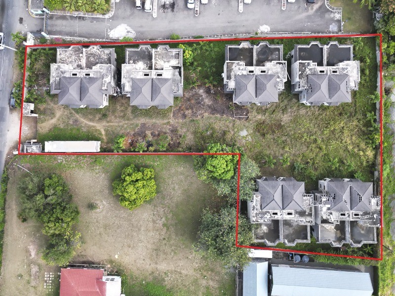
🗺️ Property Map
Interactive map showing the exact property boundaries and location
Loading map...
AI-powered estimation based on comprehensive analysis of location, demographics, infrastructure, and market factors
Estimated Value (JMD)
JMD 64,104,674
Estimated Value (USD)
USD 427,364
Confidence Score
75%
Market Multiplier
0.92x
📊 Value Range Analysis
JMD Range:
JMD 51,283,739 - JMD 76,925,609
JMD 51,283,739 - JMD 76,925,609
📊 Analysis Details
Summary: AI analysis indicates a land value of JMD 64,104,674 based on 75% confidence analysis of population density, building count, facilities, and environmental factors.
Key Factors: Population density: 7385 people • Building count: 0 • Nearby facilities: 0 • Environmental score: 0.0% • Economic score: 0.0%
Tax Status: Not Available
Legal: Property appears to be legally registered
Improvements: Vacant land with development potential
In and Around
Buildings, public facilities, attractions and transport identified at or near this parcel — sourced from OpenStreetMap and our analysis pipeline.
Public Facilities
4- Denham Town High SchoolNearby257 mSchool
- Denham Town Primary SchoolNearby340 mSchool
- Denham Town Police StationNearby372 mPolice Station
- Kingston Public HospitalNearby422 mHospital
Retail & Commercial
2- Saint Anne Catholic ChurchNearby299 mPlace of Worship
- Scoop Scoop Ice Cream ParlourNearby410 mShop
Transport
5- FootwayInside
- ResidentialNearby23 m
- Wellington StreetNearby67 mResidential
- Dumfries StreetNearby88 mResidential
- Regent StreetNearby95 mResidential