Milk Lane, Newport East, Kingston
Property information for Milk Lane, Newport East, Kingston
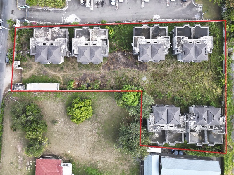
🗺️ Property Map
Interactive map showing the exact property boundaries and location
Loading map...
AI-powered estimation based on comprehensive analysis of location, demographics, infrastructure, and market factors
Estimated Value (JMD)
JMD 158,411,450
Estimated Value (USD)
USD 1,056,076
Confidence Score
80%
Market Multiplier
1.12x
📊 Value Range Analysis
JMD Range:
JMD 126,729,160 - JMD 190,093,740
JMD 126,729,160 - JMD 190,093,740
📊 Analysis Details
Summary: AI analysis indicates a land value of JMD 158,411,450 based on 80% confidence analysis of population density, building count, facilities, and environmental factors.
Key Factors: Population density: 57016 people • Building count: 21 • Nearby facilities: 0 • Environmental score: 0.0% • Economic score: 0.0%
Tax Status: Not Available
Legal: Property appears to be legally registered
Improvements: Property has existing structures
In and Around
Buildings, public facilities, attractions and transport identified at or near this parcel — sourced from OpenStreetMap and our analysis pipeline.
Public Facilities
5- Denham Town High SchoolNearby54 mSchool
- Denham Town Primary SchoolNearby206 mSchool
- Denham Town Police StationNearby258 mPolice Station
- Kingston Public HospitalNearby447 mHospital
- Tivoli Gardens HighNearby682 mSchool
Retail & Commercial
5- Crazy Jim Wholesale DepotNearby259 mShop
- Internet CafeNearby266 mInternet Cafe
- All Purpose LocksmithNearby272 mShop
- Scoop Scoop Ice Cream ParlourNearby278 mShop
- Saint Anne Catholic ChurchNearby380 mPlace of Worship
Transport
9- Milk LaneInsideResidential
- Metcalfe StreetInsideResidential
- Market StreetInsideResidential
- Dumfries StreetInsideResidential
- UnclassifiedNearby8 m
- Last StreetNearby50 mResidential
- Tulip LaneNearby51 mResidential
- Wellington StreetNearby51 mResidential