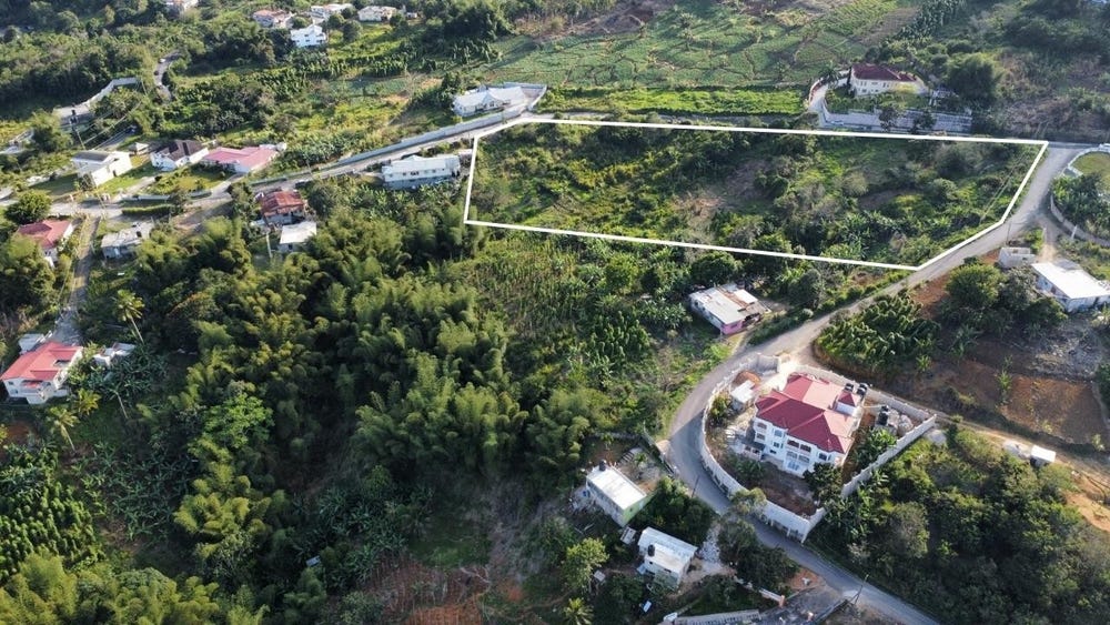
🗺️ Property Map

Interactive map showing the exact property boundaries and location

Loading map...

Interactive property boundary map located in Part of Spaldings, Manchester parish, Jamaica.

Tax & Investment Information

What you get when you unlock this parcel

Boundary maps, lot size, scheme details, AI valuation insight and OFMOP local context are already free on this page. The unlock adds the verified Tax & Ownership record:

  • 👤 Owner of record — name and registered address from TAJ
  • 💰 Annual property tax — current amount due + paid/unpaid status from TAJ
  • 📊 Assessed value — the unimproved value TAJ uses to compute the tax
  • 📜 Payment history — recent tax-payment entries on the parcel

Tax records sourced from Tax Administration Jamaica (TAJ). Land boundaries and lot dimensions come from the National Land Agency (NLA) and are already on this page.

One-time per parcel, or unlimited with Premium. Receipts in your customer portal.

AI-powered estimation based on comprehensive analysis of location, demographics, infrastructure, and market factors

Estimated Value (JMD)
JMD 27,316,155
Estimated Value (USD)
USD 182,108
Confidence Score
95%
Market Multiplier
0.97x
📊 Value Range Analysis
JMD Range:
JMD 21,852,924 - JMD 32,779,386
📊 Analysis Details
Summary: AI analysis indicates a land value of JMD 27,316,155 based on 95% confidence analysis of population density, building count, facilities, and environmental factors.
Key Factors: Population density: 1696 people • Building count: 2 • Nearby facilities: 0 • Environmental score: 0.0% • Economic score: 0.0%
Tax Status: Available
Legal: Property appears to be legally registered
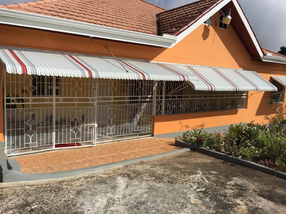
Improvements: Property has existing structures

In and Around

Buildings, public facilities, attractions and transport identified at or near this parcel — sourced from OpenStreetMap and our analysis pipeline.

Transport

2

Property record

ID: 720083

This 2,078 m² parcel measures roughly 58 m wide by 91 m deep, with a 9-vertex boundary.

Manchester is a central highlands parish — cool upland in character, centered around the hillside town of Mandeville.

Middlesex County is Jamaica's largest historic county by area, covering the central interior with cool elevations and strong agricultural character.

Located 0.5 km from the centre of Part of Spaldings and 13.2 km from Mandeville, the parish capital.

OpenStreetMap places this parcel within Glencoe Road, Spaldings, Manchester, Middlesex County, Jamaica. OSM classifies the surrounding area as residential.

Satellite imagery detects 2 structures within the parcel boundary, suggesting a developed lot.

Vegetation cover reads as moderate green (NDVI 0.55).

Nearest highway: Glencoe Road, approximately 235 m from the parcel boundary.

Indicative AI valuation: JMD 27,316,155 ≈ USD 182,108 (95% confidence).

🏠 Nearby on the market

🏠 Real Estate Investment Opportunities

Discover properties for sale and rent in this prime location. Perfect for investors looking for opportunities in this growing area.

💰Properties for Sale

2 Available
CALAND HEIGHTS
FOR SALE
1 / 10

CALAND HEIGHTS

JMD $21,000,000

0
📏128,938.00 sq ft

👨‍💼Luciano Kelly

🏢KELLER WILLIAMS JAMAICA

CLANDON, SPALDING , MANCH
FOR SALE
1 / 10

CLANDON, SPALDING , MANCH

JMD $35,000,000

🛏️5 beds
🚿3 baths
📏17,451.00 sq ft
🏢4,100.00 sq ft

👨‍💼Evora Mais-thompson

🏢GOURZONG REALTY GROUP LIMITED

🏠Properties for Rent

0 Available
🏠

No Properties for Rent

Currently no properties available for rent in this area.

📊 Investment Summary

2
Properties for Sale
0
Properties for Rent
2
Total Opportunities

Checking access...

Powered by Jurifi · Jamaica legal Q&A

Have a legal question about this property? Tap a prompt to open Jurifi with the parcel context already filled in.

AI assistance only. Not legal advice. Consult a Jamaican attorney before acting on any output.

Nearby Properties in Part of Spaldings