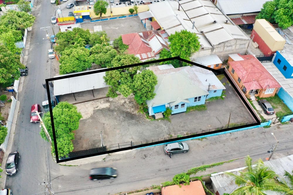
Holborn Road, New Kingston, St. Andrew
Property information for Holborn Road, New Kingston, St. Andrew
🗺️ Property Map
Interactive map showing the exact property boundaries and location
Loading map...
AI-powered estimation based on comprehensive analysis of location, demographics, infrastructure, and market factors
Estimated Value (JMD)
JMD 92,531,352
Estimated Value (USD)
USD 616,876
Confidence Score
80%
Market Multiplier
0.97x
📊 Value Range Analysis
JMD Range:
JMD 74,025,082 - JMD 111,037,622
JMD 74,025,082 - JMD 111,037,622
📊 Analysis Details
Summary: AI analysis indicates a land value of JMD 92,531,352 based on 80% confidence analysis of population density, building count, facilities, and environmental factors.
Key Factors: Population density: 36276 people • Building count: 1 • Nearby facilities: 0 • Environmental score: 0.0% • Economic score: 0.0%
Tax Status: Not Available
Legal: Property appears to be legally registered
Improvements: Property has existing structures
In and Around
Buildings, public facilities, attractions and transport identified at or near this parcel — sourced from OpenStreetMap and our analysis pipeline.
Public Facilities
4- Centre For Investigation Of Sexual Offences & Child AbuseNearby119 mPolice Station
- Andrews Memorial HospitalNearby377 mHospital
- Saint Andrew High School for GirlsNearby505 mSchool
- Ardenne High SchoolNearby751 mSchool
Attractions
2- Peter tosh museumNearby102 m
- Ruthven Road Community playfieldNearby139 m
Retail & Commercial
5- NCB Atrium ATMNearby190 mATM
- NCB Drive Through ATMNearby210 mATM
- Knutsford ExpressNearby245 mBus Station
- Supermed PharmacyNearby281 mPharmacy
- Sagicor Life Jamaica LimitedNearby284 mBank
Transport
4- Renfrew RoadNearby8 mResidential
- ServiceNearby17 m
- Traffic SignalsNearby71 mTraffic Signals
- Haughton TerraceNearby71 mResidential