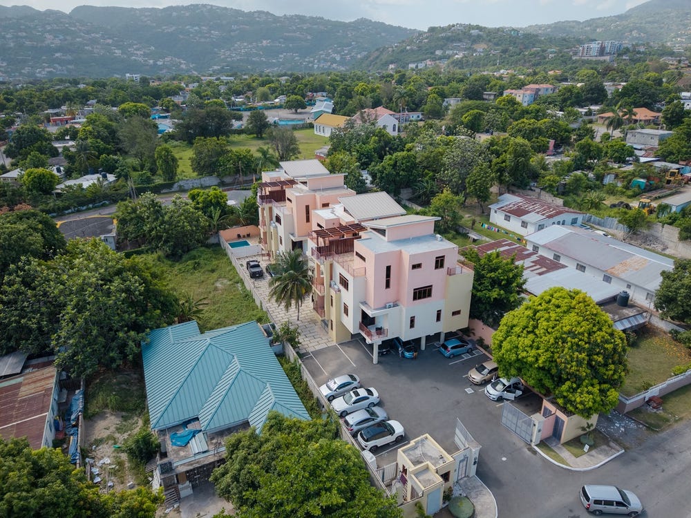
St. Johns Lane, Whitehall, St. Andrew
Property information for St. Johns Lane, Whitehall, St. Andrew
🗺️ Property Map
Interactive map showing the exact property boundaries and location
Loading map...
AI-powered estimation based on comprehensive analysis of location, demographics, infrastructure, and market factors
Estimated Value (JMD)
JMD 52,929,475
Estimated Value (USD)
USD 352,863
Confidence Score
80%
Market Multiplier
0.97x
📊 Value Range Analysis
JMD Range:
JMD 42,343,580 - JMD 63,515,370
JMD 42,343,580 - JMD 63,515,370
📊 Analysis Details
Summary: AI analysis indicates a land value of JMD 52,929,475 based on 80% confidence analysis of population density, building count, facilities, and environmental factors.
Key Factors: Population density: 23811 people • Building count: 1 • Nearby facilities: 0 • Environmental score: 0.0% • Economic score: 0.0%
Tax Status: Not Available
Legal: Property appears to be legally registered
Improvements: Property has existing structures
In and Around
Buildings, public facilities, attractions and transport identified at or near this parcel — sourced from OpenStreetMap and our analysis pipeline.
Public Facilities
2- Quest Pre-SchoolNearby347 mSchool
- Swallow field Primary and Junior HighNearby468 mSchool
Attractions
2- Jamaica Methodist Deaconess HouseNearby244 m
- Oakland Apartment Tennis CourtNearby442 m
Retail & Commercial
5- Whitebones SeafoodNearby204 mRestaurant
- NCBNearby252 mATM
- Richie B's Liquor CentreNearby253 mShop
- PubNearby254 m
- Saxthorpe Methodist ChurchNearby287 mPlace of Worship
Transport
2- ResidentialNearby71 m
- Sullivan AvenueNearby115 mResidential