B6, Carisbrook, St. Elizabeth
Property information for B6, CARISBROOK P A, Carisbrook, St. Elizabeth
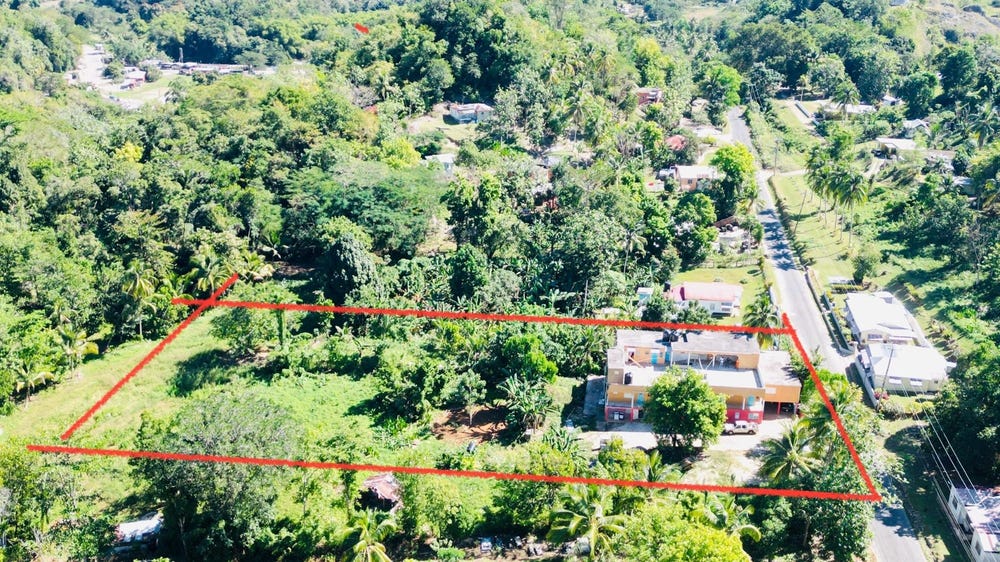
🗺️ Property Map
Interactive map showing the exact property boundaries and location
Loading map...
AI-powered estimation based on comprehensive analysis of location, demographics, infrastructure, and market factors
Estimated Value (JMD)
JMD 57,153,600
Estimated Value (USD)
USD 381,024
Confidence Score
95%
Market Multiplier
1.02x
📊 Value Range Analysis
JMD Range:
JMD 45,722,880 - JMD 68,584,320
JMD 45,722,880 - JMD 68,584,320
📊 Analysis Details
Summary: AI analysis indicates a land value of JMD 57,153,600 based on 95% confidence analysis of population density, building count, facilities, and environmental factors.
Key Factors: Population density: 4159 people • Building count: 4 • Nearby facilities: 0 • Environmental score: 0.0% • Economic score: 0.0%
Tax Status: Available
Legal: Property appears to be legally registered
Improvements: Property has existing structures
In and Around
Buildings, public facilities, attractions and transport identified at or near this parcel — sourced from OpenStreetMap and our analysis pipeline.
Attractions
1- Apple Valley ParkNearby509 m
Transport
3- ServiceNearby176 m
- Newton - Maggotty RoadNearby310 mTertiary
- ResidentialNearby366 m